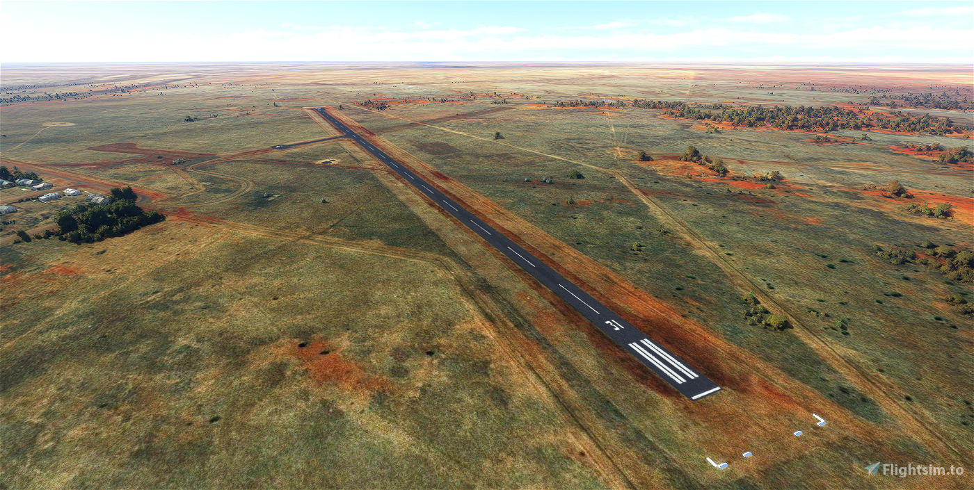
Camooweal Airport is a small aerodrome serving the town of Camooweal, Queensland, which sits about 165km northwest of Mount Isa on the border with the Northern Territory. It is operated primarily to accommodate weekly Royal Flying Doctor Service flights to support their primary and specialist medical clinics for the remote town. It is also used as a supply drop off and evacuation point during natural disasters, like severe flooding and wildfires.
The main focus here was to remove all the random auto-generated taxiway signs. This scenery uses all stock assets, you don't need to download anything else for it to work.
Version 1.1:
- Added star to World Map to make locating the airport easier
- Corrected windsock orientation
- Removed the blurry autogen roads from the town and surrounding areas
Version 1.0:
-Removed about a dozen taxiway signs near the disused runways that don't exist in real life
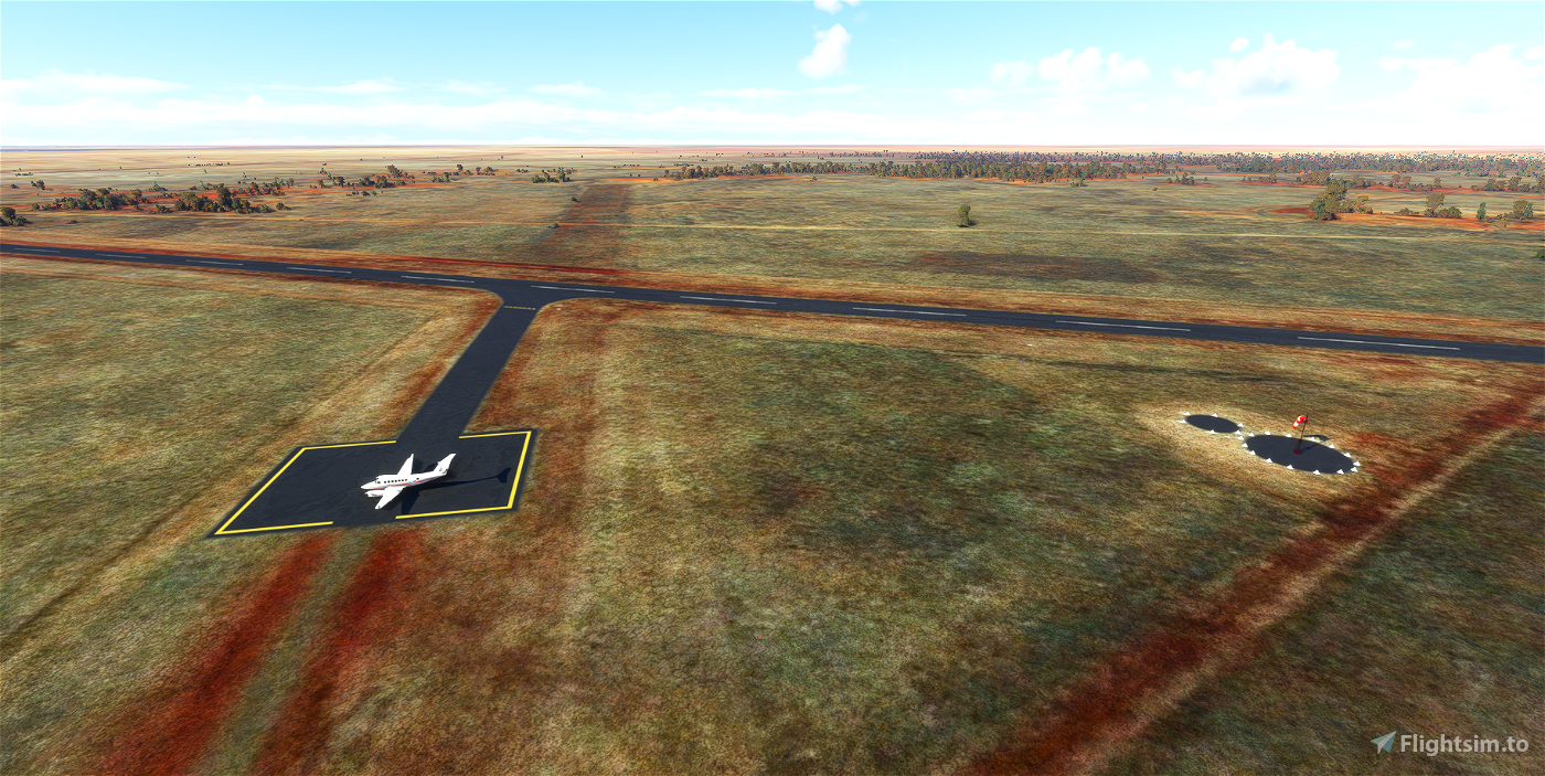
-Improved apron and painted lines to be more accurate
-Added a stand so you can start on the apron
-Fixed windsock location and pad
-Added gables
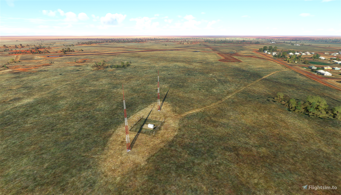
-Added the two NDB masts and equipment in the fenced off area just to the southwest of the airport
-Fixed some trees
-Misc. scenery additions/fixes
-Removed the blurry auto-gen road from the south side of the airport
-Removed the unrealistic army of ground staff
Known Issues:
-No perimeter fence (won't happen until Asobo develops a fence tool)
There wasn't much to do here, but if I've overlooked anything or if you have any suggestions, please leave a comment.
Thanks, and enjoy!

 kliff0rd


Love it. What about putting a POI star here?
3 years ago
I've uploaded a new version that has a star on the World Map and a few other minor fixes.
Thank you and enjoy
3 years ago
kliff0rd
SWISSBEACH87
3 years ago
3 years ago
kliff0rd
conan222
3 years ago
3 years ago
kliff0rd
antonvs_AU
3 years ago
3 years ago
kliff0rd
hinesy32
3 years ago
3 years ago
kliff0rd
jim007