
Specially for VFR flying Netherlands.
Nijmegen Landmarks.
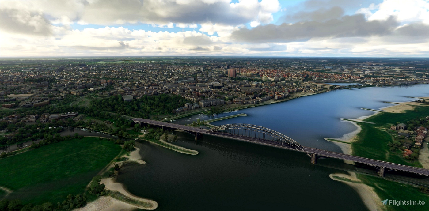
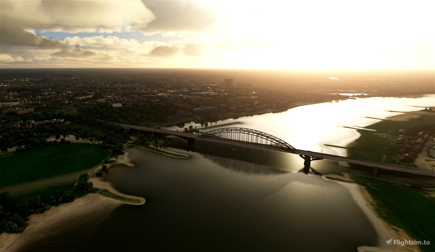
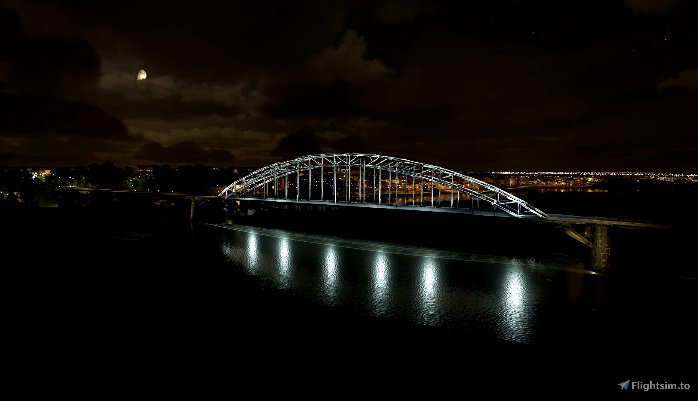
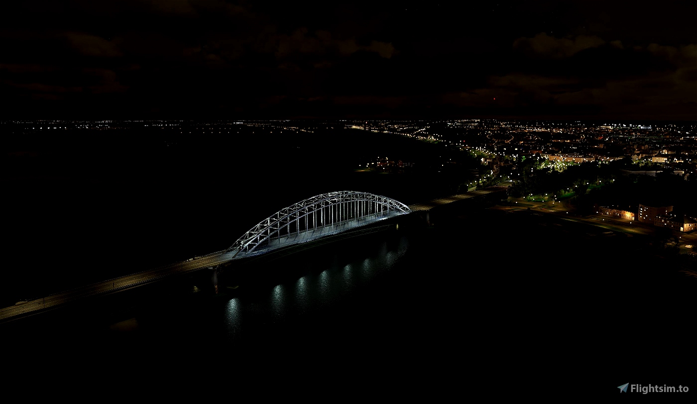
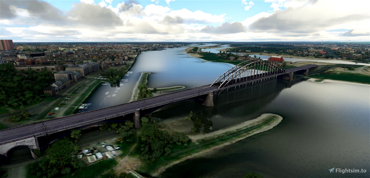
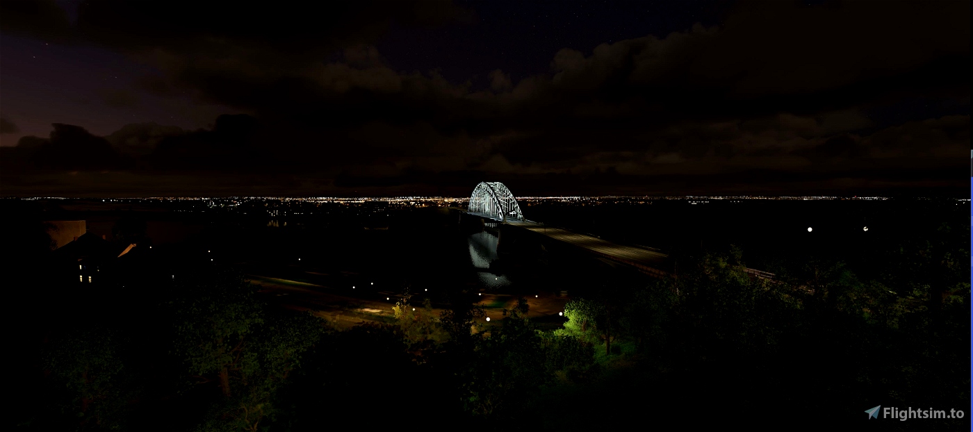
Waalbrug
The Waalbrug is an arch bridge over the Waal River in Nijmegen, Gelderland, the Netherlands. The full length of the Waalbrug is 604 metres (1,982 ft), the middle of the arch being about 65 metres (213 ft) high. The arch itself is 244.1 metres (801 ft) long and was the longest arch in Europe at the time of construction.
Unlike many other bridges from the same period and with the same construction, like the IJsselbrug near Zwolle, the Graafsebrug and the bridge near Arnhem, the Waalbrug is an arch bridge in the literal sense: all forces truly work on the two pylons.
At the start of the Second World War the Dutch combat engineering units blew up the bridge to stop the German army's advance. During the occupation the Germans restored the bridge and from 1943 it was in use for traffic again.
In 1944 during MARKET GARDEN, the Germans planned to blow up the bridge again, but Jan van Hoof, a Rover Scout and member of the Dutch Resistance, managed to prevent this. On 20 September 1944, the bridge was conquered by allied forces. A plaque was added to the bridge as a reminder of van Hoof's actions.
In the movie "A Bridge Too Far" this bridge was together with the bridge in Arnhem (John Frost Bridge) the main targets and film sets. Moviestars like Robert Redford, Gene Hackman and many more showed up for the filming.
The bridge was painted green until 1980, these days it is white. Although in 2020 they started with restauration of the paintscheme.
My personal history:
I loved and hated this bridge. During my young school years, I needed to cycle over this bridge every day. Nice weather or wet/cold weather.
On the other side it is one of our pride symbols of the city Nijmegen. Particularly during the yearly International and famest 4 Days March Nijmegen.
https://www.4daagse.nl/en/
-----------------------------------------------------------
File credits
This free creation contains content from Google Maps or Google Earth. In accordance with Google Terms of Services and especially point 2.2 of Google Maps/Google Earth Additional Terms of Service, this creation is based on « fair use » or « fair dealing » of the data provided by google throught its services. No commercial use or any gain is or will ever be made by the author of this creation, who doesn’t own anything regarding google assets but a simple user Licence. According to the following document https://www.google.com/intl/en-GB/permissions/geoguidelines/, the author is freely sharing a creative application of Google Maps or Google Earth. The author will not recieve any form of retribution for sharing his work, even general donations from users of file hosting web services under the form of « rewards » or « tips ». If this content would be found somewhere where it is provided in exchange of money or any kind of retribution, I wouldn’t be with the consent of the author who will stick to strict free content creation diffusion.
Part of this content including 3d data and textures is copyrighted by
Imagery ©2020 Google, Imagery ©2020 CNES/ Airbus, Maxar Technologies,
USDA Farm Service Agency, Map data ©2020 Google.

 Geraldar98


1 months ago
CaptainMoonlight
4 years ago
4 years ago
Geraldar98
Dopplergamer
4 years ago
4 years ago
Geraldar98
pattle
I'm also amazed by the speed of all your achievements. Years ago I was a member of the NL2000 team and we made nice sceneries but never with the speed you show us. Compliments!
4 years ago
4 years ago
Geraldar98
Tom
: Thanks a lot for all your NL contributions, great work!
4 years ago
4 years ago
Geraldar98
Joppnl
4 years ago
Flyingdutchie
4 years ago
PHMAC