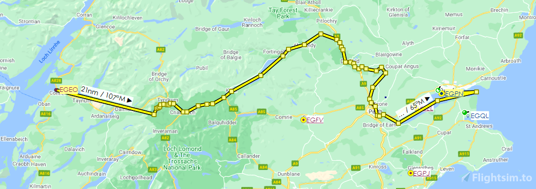
The River Tay is Scotland’s longest river, at 117 miles/188 kilometres. The flight plan described below is included in both .pln and .lnmpln formats (after downloading them, navigate to the .pln file in MSFS's World Map screen, and/or to the .lnmpln file in Little Navmap). The safe flying altitude is 4,500 feet until you get to Dunkeld; from there you can descend to your preferred altitude. I recommend the CubCrafter xCub if you want autopilot to handle the route while you take in the views. The route should take just over an hour at around 100 knots cruise speed.
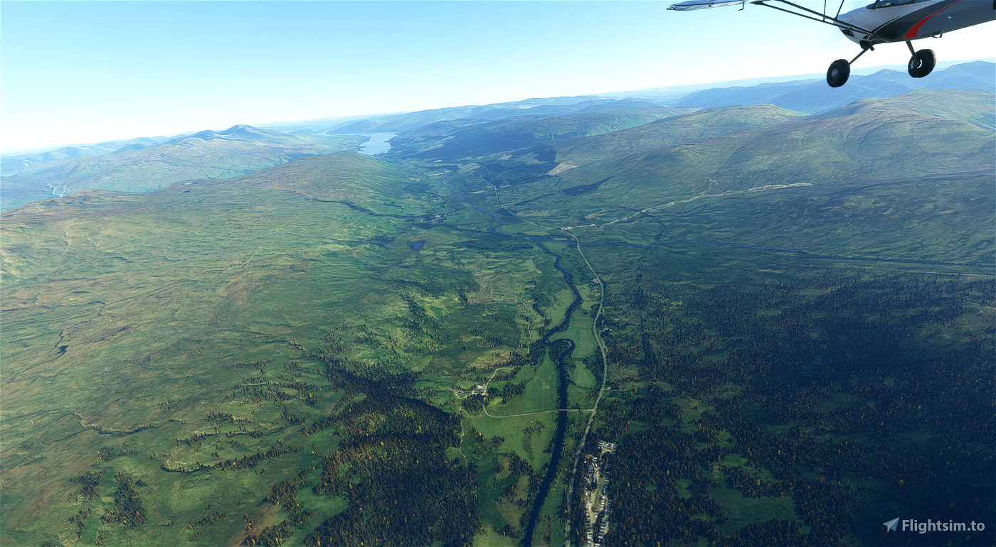
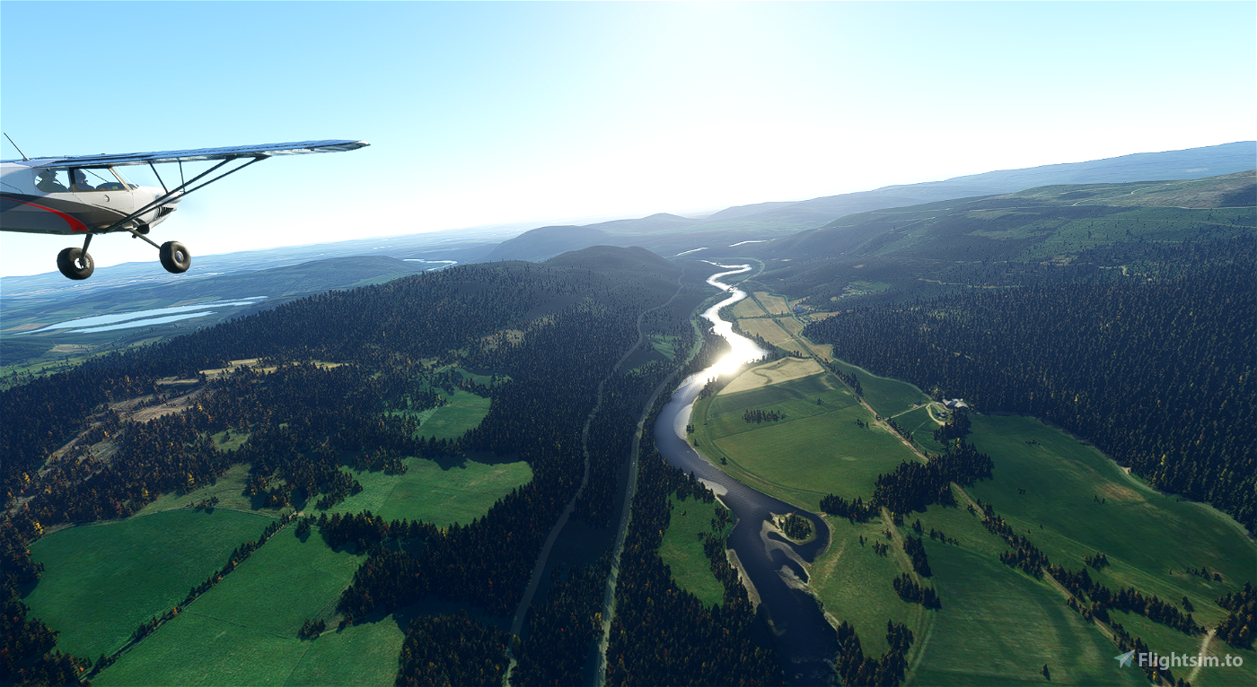
We begin our flight at Oban Airport (EGEO) and depart for the source of the river, twenty miles to the east, on the slopes of Ben Lui, at the northwestern edge of Loch Lomond & the Trossachs National Park. With an initial elevation of 2,360 feet/720 metres, the river starts off flowing north as the River Cononish, then east, becoming the River Fillan as its course turns south at the West Highland Way near Auchtertyre, following the A82 on the right of the river. At Crianlarich, it turns east again, flowing through lochs Dochart and Iubhair, after which it becomes the River Dochart. Continuing northeast, it enters Loch Tay at Killin, before exiting at Kenmore as the River Tay. A northeast course continues for about ten miles, then a south turn as we meet with the A9 near the confluence with the River Tummel. The A9 is on the eastern (left) side of the river, running parallel with the Highland Main Line railway.
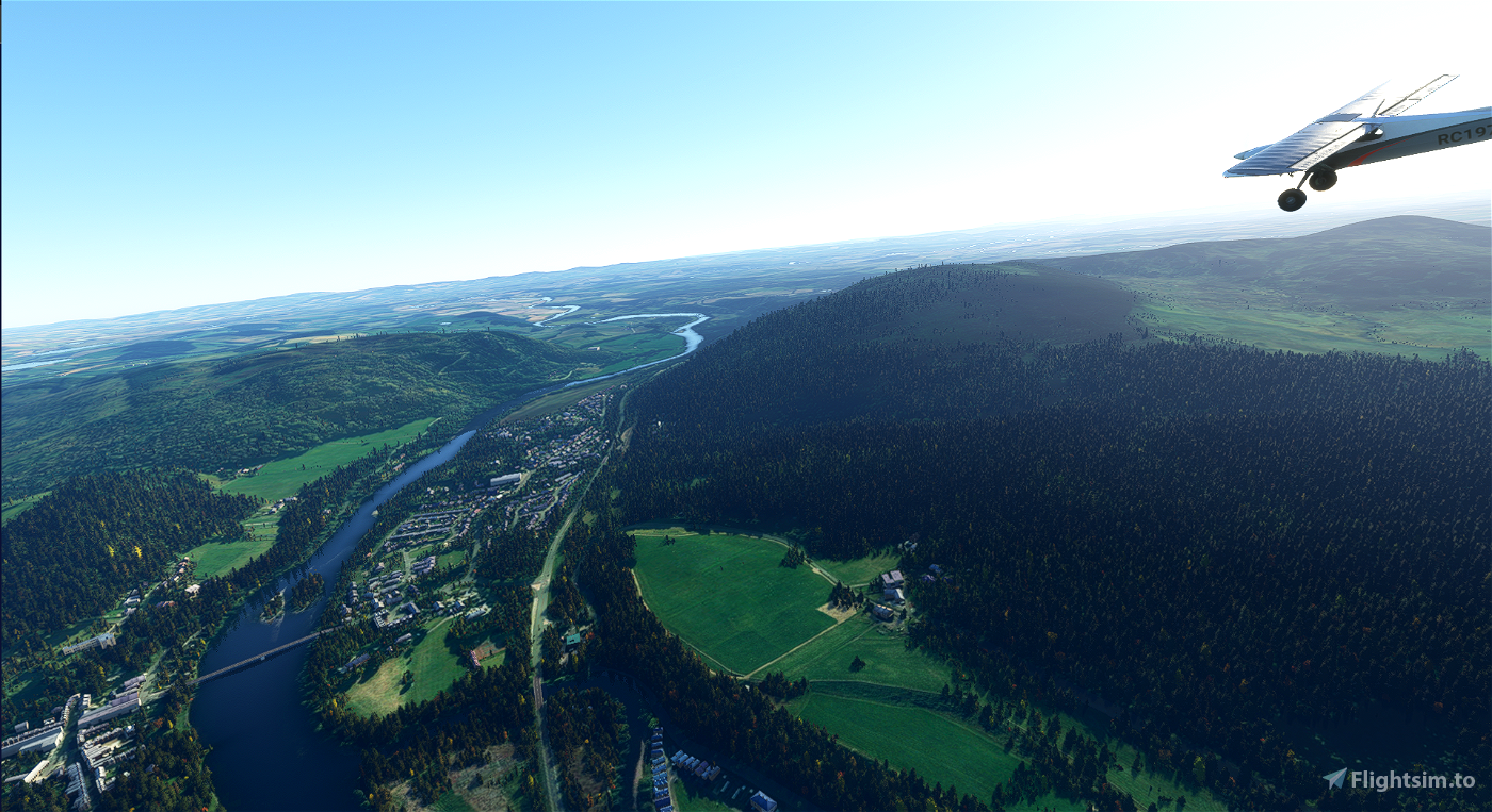
We fly over the popular fishing section near Dalguise (where the Highland Main Line crosses to the western side of the river) and Dalmarnock, beside Tay Forest Park, before turning east briefly just outside Dunkeld.
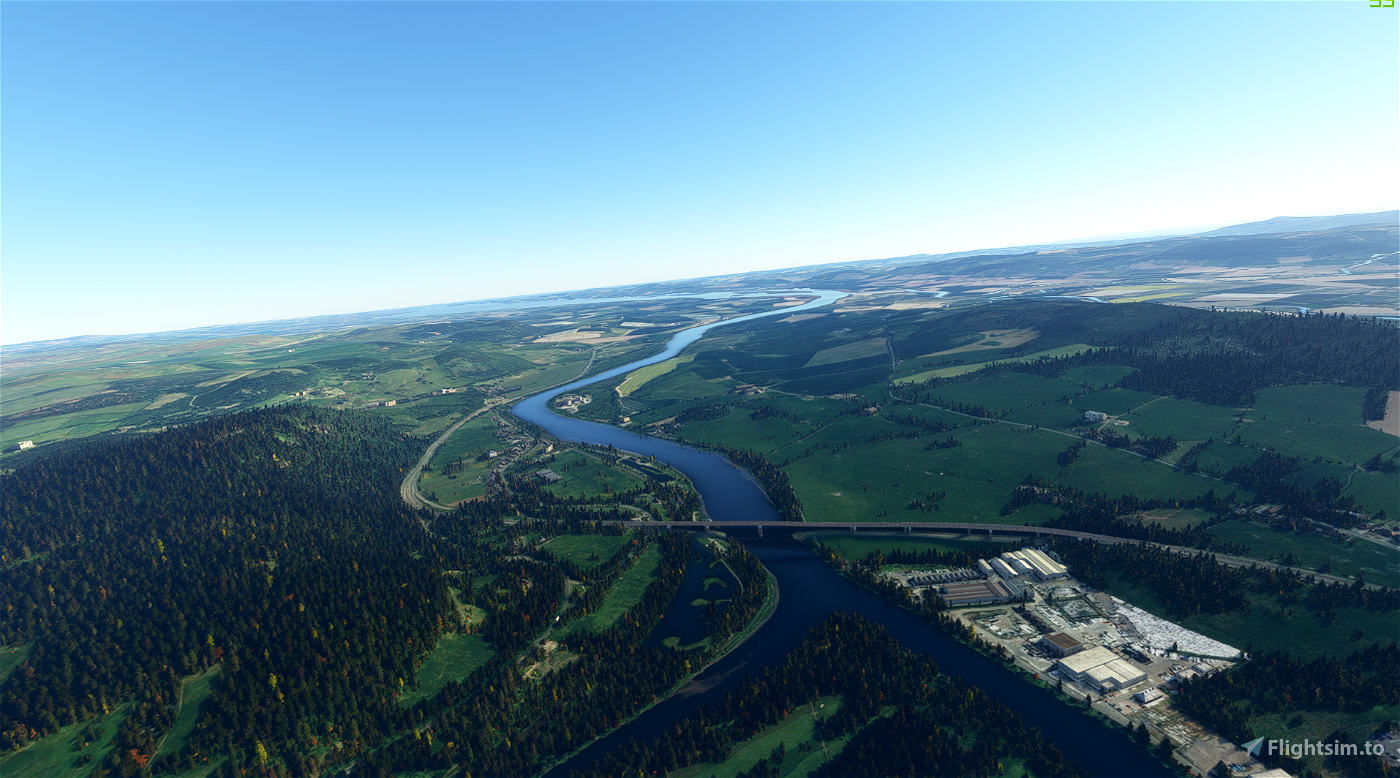
Continuing southeast, we pass beside the Old Military Road to the left, before turning sharply southwest at Kinclaven, where the River Isla flows into the Tay.
The river becomes very winding in the section from Cargill to Stanley, so we will maintain a straight course. At the latter village we turn slightly more to the south, en route to Scone.
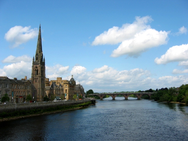
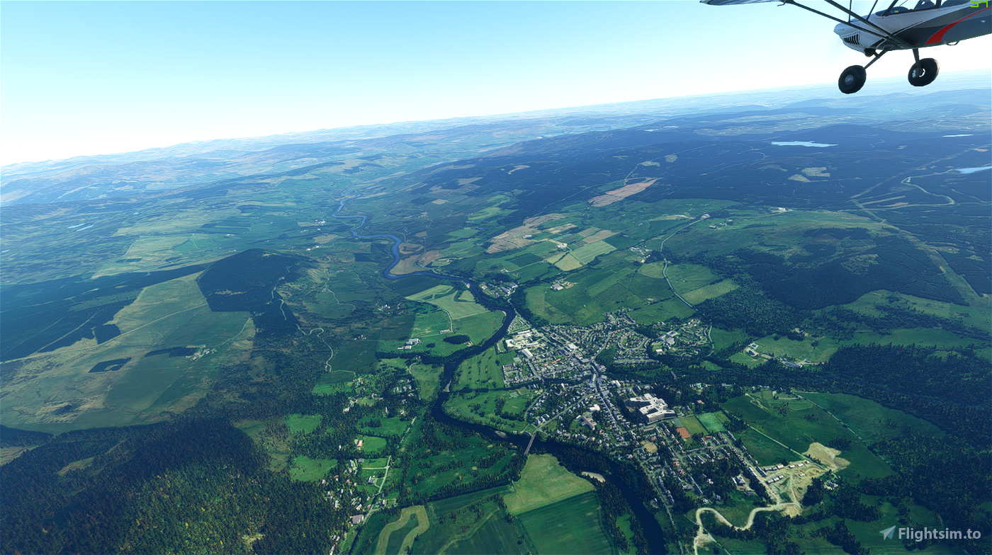
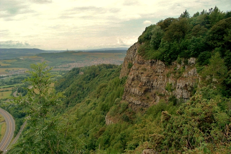
The River Almond flows in just north of Perth, before we enter the Muirton part of the city. The North Inch public park is on our right as we continue due south to the 1771-built Smeaton’s Bridge, the first of the four bridges that span the Tay at Perth.
Next is Queen’s Bridge, opened by Queen Elizabeth II in 1960.
The third bridge is a single-track bridge carrying trains to and from Perth’s railway station half a mile to the northwest.
We now fly over Moncrieffe Island, home of King James VI golf course, which divides the Tay in half briefly.
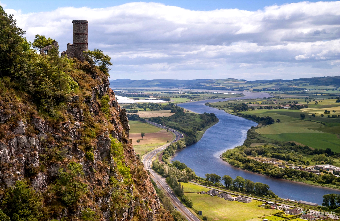
Turning due east, we pass over the fourth bridge, Friarton Bridge, which carries the traffic of the M90 to and from Edinburgh in the shadow of the 728 foot/222 m Kinnoull Hill to the left.
Continuing northeast, over the Tay Bridge, we do a loop over the mouth of the Tay, at the Firth of Tay, before turning back on ourselves to land at Dundee Airport (EGPN).

 newtestleper


4 months ago
DiGiTaLSc4rZ
3 years ago
3 years ago
newtestleper
Retnavycpo1987