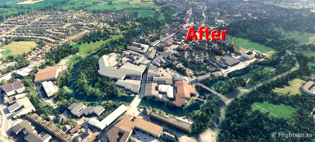
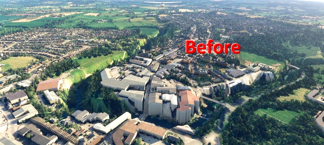
Elevation data for the River Avon at Chippenham, Wiltshire, UK is incorrect in default MSFS scenery and lies in a deep trench running through the town. Location: 51.4569° N 2.1141° W
This addon is a crude correction which flattens the ground level for 200m around the river. This means you might notice some slopes in the surrounding fields that are not true to life but I don't think you will notice anything when in flight. Also, if you have any custom scenery that lies within 200m of the river it may conflict with this addon.
The addon extends from the outskirts of Lacock in the West and to near the Railway Path in the East.
Reviews
There are no reviews yet.
Comments
Pretty empty over here.
