
Generated in LittleNavMap
This is a IFR filed Flightplan that takes you from one of the 2 Boeing Factories from the West Coast in the U.S, across the country, to one of the many major hubs in the East Coast.
The Route takes you up to a Cruise Altitude of 36,000 ft, And the Flight takes about 4 hours and 10 minutes.
Here's the Flight Plan in Description form:
KPAE DCT AYURU T268 MWH J90 RWF J34 AIR V75 MGW DCT KIAD
NOTE:
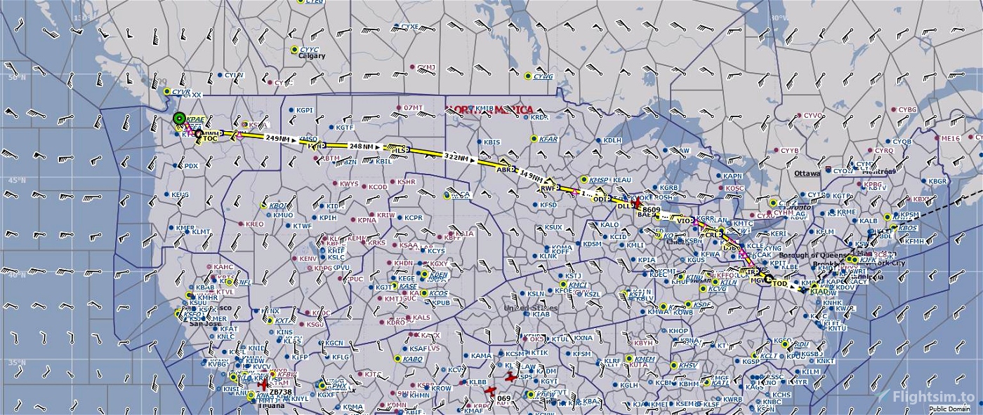
I have included an attached image showing the overview of the flightplan, which also includes the fuel remaining in Pounds, and Gallons. and Altitude.
These figures are taken from the Aircraft Performance based on the Dreamliner 787-10 shown in the thumbnail. (These figures may not be accurate depending on the type of aircraft you may fly this route with.) And the Cruise Altitude filed is 35,000 ft, which more or less matches the altitude I have flown live on YouTube.
Link to the stream: https://www.youtube.com/live/_ciKD7wOA8Y?feature=share
Standard Instrument Departures (SID) and Standard Terminal Arrival Routes (STAR) are not included, As the weather will influence which runway will be in use.
(I DO NOT OWN THE LIVERY DISPLAYED ON THE AIRCRAFT IN THE TUMBNAIL.)
The livery was created by mjv5757: https://flightsim.to/file/6193/northwest-airlines-nwa-b787-10
Smooth Takeoff and Landings to you!
Created by,
earljames1000

 earljames1000

