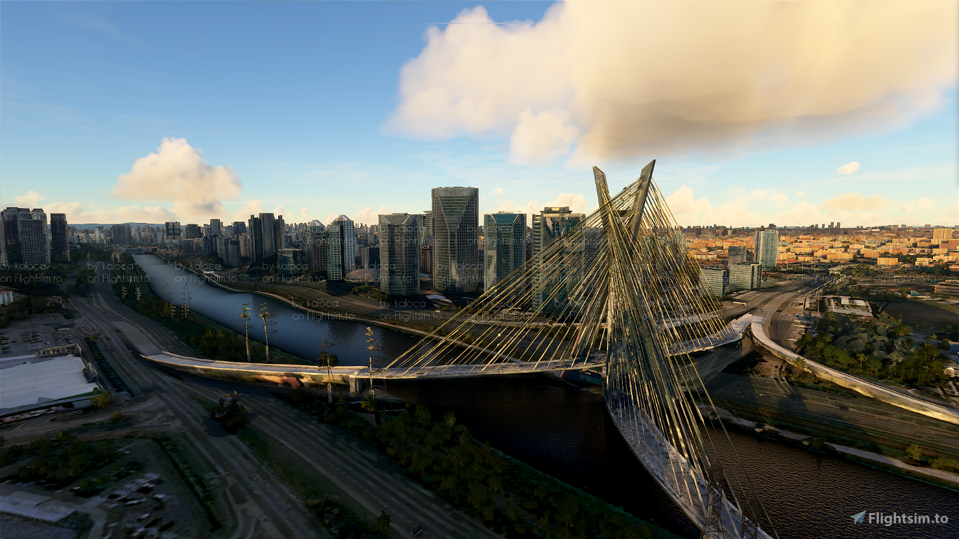
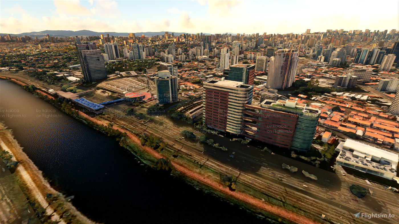
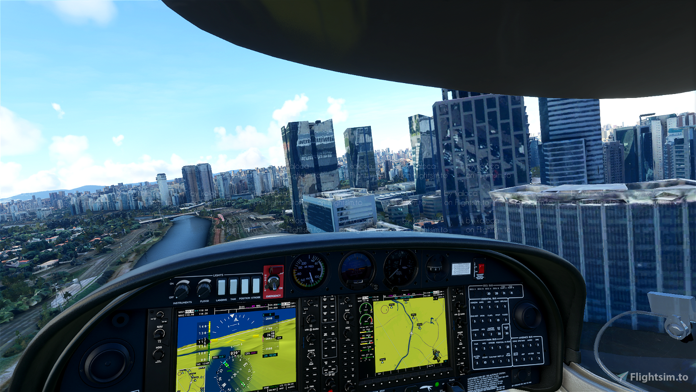

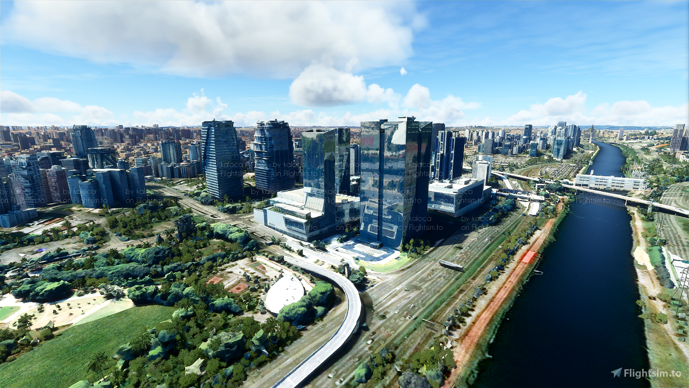
The city of São Paulo remade with Google Photogrammetry data.
Current Work in Progress
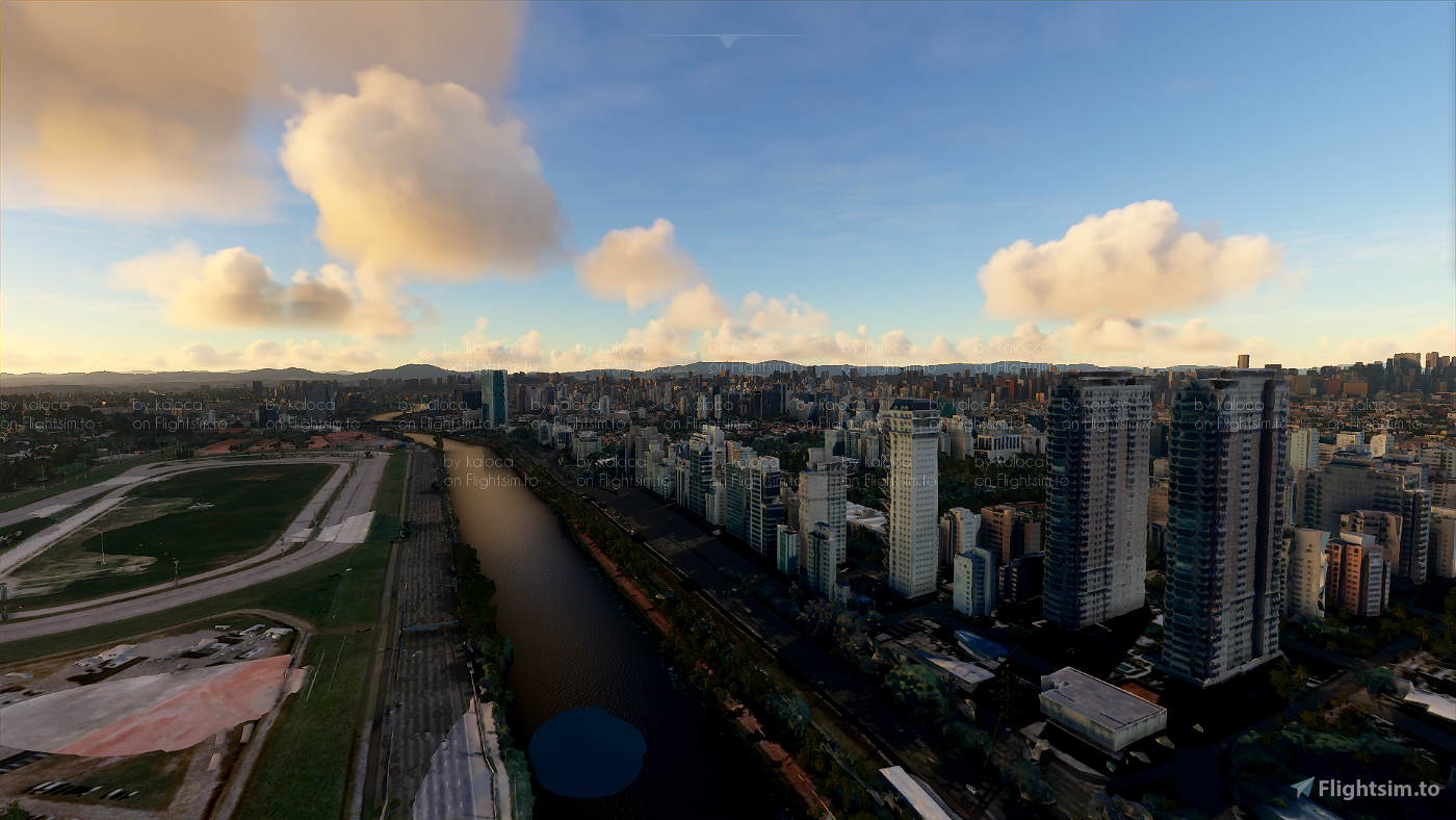
As of now, the pack already contains:
- Marginal Pinheiros
- Jockey Clube
- Ponte Estaiada
- Shopping Eldorado and Iguatemi
- Av. Faria Lima
- Buildings around JK Iguatemi
HOW TO INSTALL:
Drag and drop the 3 scenery folders inside the .zip file to your MSFS Community folder
WORK IN PROGRESS:
Next Versions Will include:
- Av. Paulista -v0.2
- Downtown around Viaduto do Chá -v0.2
- Av. Berrini and Av. JK -v0.3
- Jardins -v0.3
- Parque Ibirapuera -v0.4
### I'm also planning to make the Tietê and Pinheiros rivers look more realistic, as they are weirdly bumpy in the sim. If someone with experience in the SDK that knows how to do this well wants to help, please also hit me up.
CREDITS:
This free creation contains content from Google Maps or Google Earth. In accordance with Google Terms of Services and especially point 2.2 of Google Maps/Google Earth Additional Terms of Service, this creation is based on « fair use » or « fair dealing » of the data provided by google throught its services. No commercial use or any gain is or will ever be made by the author of this creation, who doesn’t own anything regarding google assets but a simple user Licence. According to the following document https://www.google.com/intl/en-GB/permissions/geoguidelines/, the author is freely sharing a creative application of Google Maps or Google Earth. The author will not recieve any form of retribution for sharing his work, even general donations from users of file hosting web services under the form of « rewards » or « tips ». If this content would be found somewhere where it is provided in exchange of money or any kind of retribution, I wouldn’t be with the consent of the author who will stick to strict free content creation diffusion.
Part of this content including 3d data and textures is copyrighted by
Imagery ©2020 Google, Imagery ©2020 CNES/ Airbus, Maxar Technologies,
USDA Farm Service Agency, Map data ©2020 Google.


7 months ago
Snoopy7412
Terrible, it was clearly imported with max LOD, so for the TINY area it updates (part of the Pinheiros river and surroundings) it is a huge download and drops your FPS to a halt. When you do a scenery pack should aim at good visual fidelity at around 2000~3000ft, not to be able to see a fly in the buildings windows.
2 years ago
You should consider that some people do, in fact, want to see the flies on each and every window. Most sceneries are FPS impactful and are made with those people in mind. There's nothing inherently bad about a scenery being made with max LOD.
2 years ago
Nirva
Caiobrz
Boa tarde, seria legal se pudesse pousar nos helipontos dos predios!
3 years ago
eapfly
Olá amigo, gostei, muito obrigado! Vc irá lançar atualizações? Principalmente no entorno de SBSP? Shop Ibira, hotés do aeroporto, Jabaquara, Moema etc.
3 years ago
Tomcatters
3 years ago
brunocarvalho
3 years ago
knivesout33
3 years ago
demonio666
https://www.youtube.com/watch?v=KgOpbs_P_VQ&t=23s
3 years ago
3 years ago
victorviana
kikiessam
4 years ago
greensones
4 years ago
4 years ago
kaloca
Levelupgamers
4 years ago
MauGx3
4 years ago
4 years ago
kaloca
colombo
4 years ago
4 years ago
langella
VilsonJC
4 years ago
davidcg
4 years ago
vale