
Experience New Zealand (Part 2 of 2 - Files 3 and 4 of 4)
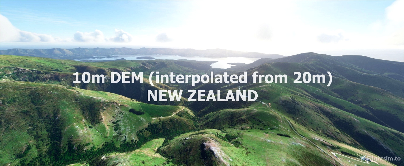
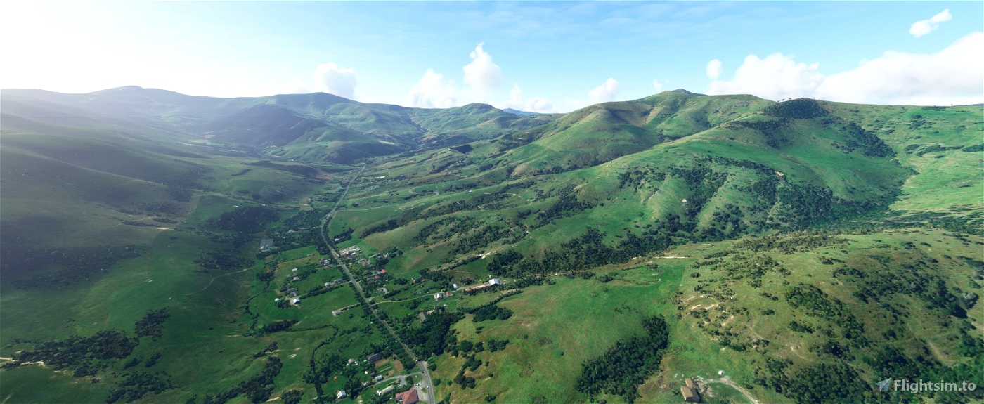
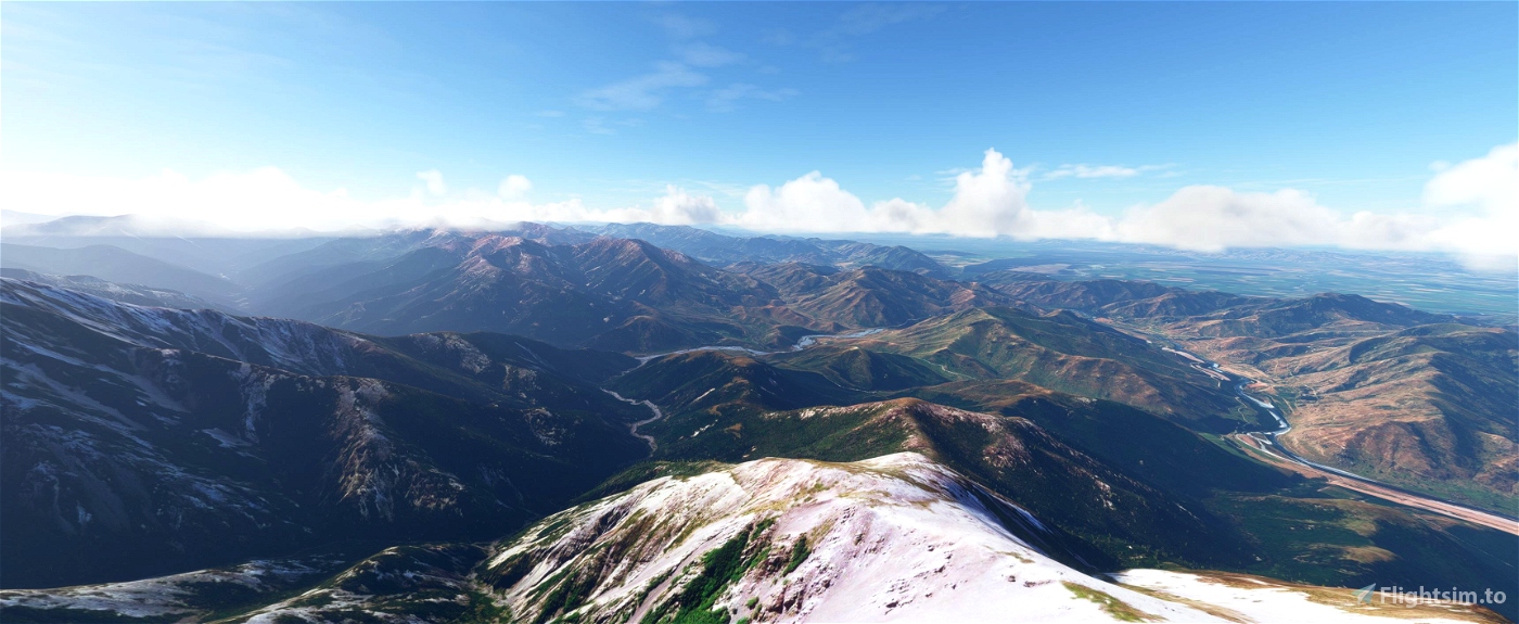
This mod contains customized height profiles. The mod contains a 10m elevation profile interpolated out of a 20m elevation model. (LINZ - Land Information New Zealand)
Many airports are already excluded.
Installation
Download Part 1 - File 1 and 2, Part 2 - File 3 and 4.
Extract all 4 files to the community folder everything will be in one folder at the end. All files merge into each other. (you can overwrite existing files)
IMPORTANT
Disclaimer: The creator of this mod is not responsible for any problems, damage, incompatibilites to other mods or performance issues that might occur.
Please note, that this mod is a very high resolution mesh. The elevation data is applied through terraforming rectangles, thus loaded at a certain distance from the player. When travelling fast or at high alitude (wide range of view) there might be too many new rectangles loaded simultaneously and thus stutters might occure.
If you have any stutters you can try and reduce your ingame render settings or uninstall!
If you are mainly flying airliners in high altitude, there is probably no benefit for you in using this mod.
Credits
The elevation data: (https://data.linz.govt.nz/layer/51768-nz-8m-digital-elevation-model-2012/)
This 8m Digital Elevation Model (DEM) was originally created by Geographx (geographx.co.nz) and was primarily derived from January 2012 LINZ Topo50 20m contours (data.linz.govt.nz/layer/768).
It was then transfered into MSFS using MSFS Toolkit by Nool Aerosystems (https://msfs.nool.ee/)
Thank you both and for anyone reading this: Please go ahead and support them!
Thanks Troglodytus for your help!
Enjoy your VFR flights above New Zealand!

 Mikea.at


4 months ago
ColOldGuy
This implies that about half of the country is not covered. I would like to get complete coverage as I think this DEM is an enhancement.
I've only tried it near where I grew up, around south Hawkes Bay (Akitio, Cape Turnagain) and to me the scenery seems more realistic (PS, I'm a newbie , but I have considerable experience using Google Earth... about 10 years ago.. 90m DEM then..). I've not had any performance problems so far (PC has an Intel i9 12900 CPU and GeForce RTX3070)
Update: I found an article on why orbx pulled their NZ DEM ( https://forum.orbxdirect.com/topic/217215-information-regarding-nz-mesh-for-microsoft-flight-simulator/ ) and maybe the issue here is similar. So I did some comparisons of scenery against the default at Cape Turnagain... very little difference except for the shoreline... this addon looked better. Flying around Mt Cook I couldn't spot any differences.
It would be nice to know just what DEM's MSFS2020 is using . Looking forward to MSFS2024.... hopefully better resolution..
5 months ago
ColOldGuy
Just confirming that this mod has caused major stability problems for me every time I've tried it in the past several months... and I'm curious, does anyone out there still use this mod without issue, or did you move to a different mesh?
2 years ago
The method we used to make these DEM mods where never recommended for this kind of scale. It was meant for airport areas and not for whole countries. So that was more like a tech demo :D some sim updates ago it was working very well.
2 years ago
Mikea.at
goggless
Are there any word on possible updates to this as it seems there are some issues? thanks!
3 years ago
dresoccer4
Great work! Any way you can make it 5m?
3 years ago
no, this DEM things were more like a proofe of concept. if it is possible with the tool to do whole countrys. so it is super easy to do it you just need a datasource :)
3 years ago
Mikea.at
meurkel
I am lost?
Why don't you put all the files in one folder....?
Then all we have to d is place that one folder into the Community folder?
Many thanks for this great work..
Robert
3 years ago
The file size to upload is limited with 2Gb. That is why it has to be split.
3 years ago
Mikea.at
NZ1159
Everything looks great! I would love if someone could do something like this with Chile <3
3 years ago
werepug
Amazing work! Have made it from Queenstown to Picton so far and crossing the Cook straight today. Everything looks amazing but found a big trench like section missing just north of Kaikoura.
3 years ago
T0kenDesign
Do we need to download anything else besides the 'main file' in each of the two mods? I'm confused by there being files 1 & 2 in the first download, and 3 & 4 in the second. To me, it just looks like two downloads.
3 years ago
Yes every part contains 2 files so you have to download 4 files in total. :)
3 years ago
Mikea.at
FrankGehry
As another user has already stated this is a "game changer". Absolutely brilliantly done which takes NZ looking from trash to looking the way it should. I've experienced a minor drop in FPS running at Ultra settings but nothing major. Thank you very much for getting this to the people mate.
3 years ago
tehaviata
Great work on all this freeware mesh- it has been a game changer for the sim. One thing I have noticed is that D'Urville Island (large 150 km² island in the Marlborough Sounds) has been textured with sea instead of landmass. Looks very bizarre!
3 years ago
zkd0s
i tested a flight around queenstown and the landscape at north is incredible, fantastic : Greats peaks with vertiginous slopes end deep valleys with fjords too....it's a landscape unique in the world....Thank you for this great job who permit me to realise how New Zeland is an incrédible Geographic country....Incredible
3 years ago
benson09
Hi Mike, this is great to try out!! Thanks!
I have removed my Orbx NZ mesh and installed the 4 files.
Problem though at NZMC, when I take off at Mount Cook on Runway 31 there's big change suddenly in the level of the runway to a different level. Its right where there are 2 big white markers either side of the center line when the different height begins. Any ideas? Thanks
3 years ago
Cptrossco1
i fly the airliners will this look good when you are landing mate & about 10.000ft
3 years ago
Barry
this is better than Orbx !!!
excellent !!
3 years ago
Well, no Orbx provided terrain data, AND mesh (like orthophotos) while this just provides Terrain data.
In that case, does this work with Orbx mesh?
3 years ago
starflexthe2nd
abbiati50