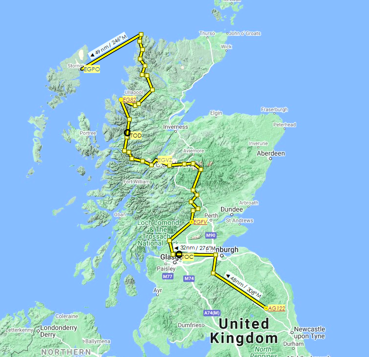
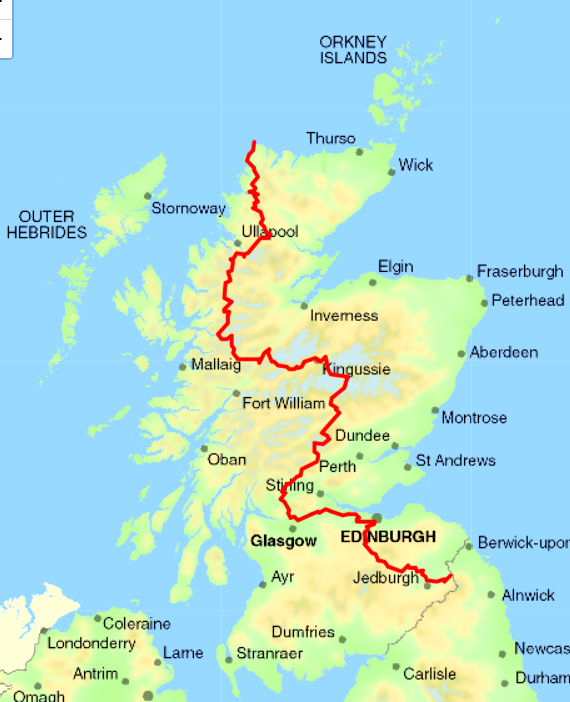
This flight plan follows the route of the (by foot) 537-mile/864-km Scottish National Trail, from Kirk Yetholm in the Scottish Borders to Cape Wrath in the Highlands. This flight plan is 381 nautical miles and includes two stops (EGFV East Lochlane and EGVZ Fort Augustus) in addition to the destination (EGPO Stornoway) airports. The safe flying altitude is 4,500 feet.
To load the route, click "load/save" at the bottom of the World Map and navigate to the relevant folder.
Departing above Northumberland National Park, we fly northwest over the Scottish Lowlands, then turn north towards Edinburgh for 14 nautical miles. Just west of the capital, we turn due west and head towards the northern extremities of Glasgow.
Around Milngavie (pronounced Mulguy), we turn north en route to the Trossachs. Just shy of Queen Elizabeth Forest Park, we turn northeast for the first time as we fly towards Perth and Kinross. Our first stop, should you so desire, is just outside Crieff and a couple of hundred feet above the River Earn.
Taking off again, we fly north to Amulree, turning at the southern end of Loch Freuchie. About halfway to Dunkeld, we turn northwest and head for Aberfeldy, on the banks of the River Tay, Scotland's longest river (see the relevant page if you want to fly the river's entire course).
Continuing northeast, our next town is Pitlochry. Turning just before the A9, we continue northwest, over a couple of bends of the River Tummel at its split with the River Garry.
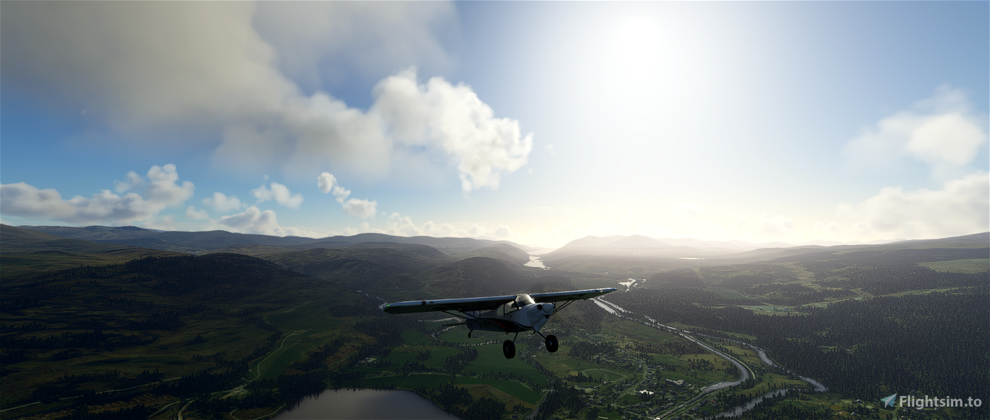
At Blair Atholl, it's a northeast turn into the Cairngorms. Just south of Ben Macdui, the second-highest mountain (at 4,295 feet / 1,309 metres) in the British Isles after Ben Nevis, we turn northwest briefly, before flying due west over the River Spey, continuing on to our second stop, Fort Augustus, near the southern shores of Loch Ness.
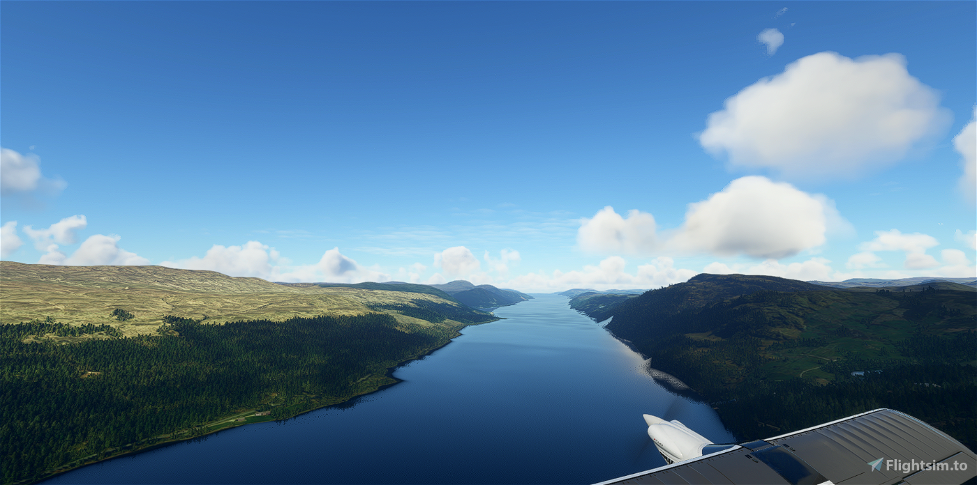
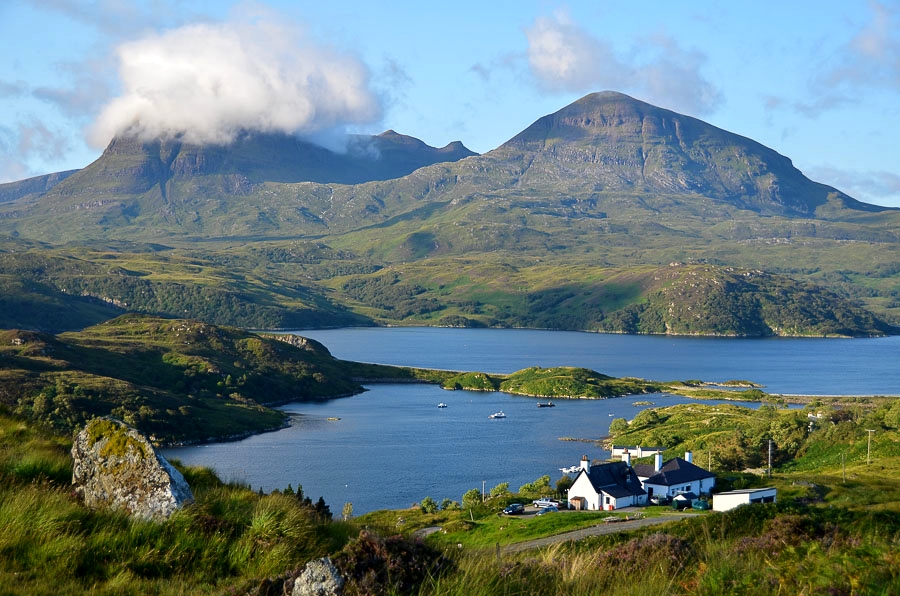
Upon departing once more, we fly southwest to the midpoint of Loch Oich, then turn to fly over it. We also fly over Loch Garry (not the source of the River Garry we saw at Dunkeld), Loch Loyne and Loch Cluanie.
Turning north, we fly above the peak of Beinn Fhada, then, after another turn towards Loch Duich, we continue due north through the Western Highlands, winding our way up to Cape Wrath.
After flying over the cliffs, we can either find a safe place to land here or continue southwest for 50 nautical miles to Stornoway.

 newtestleper

