

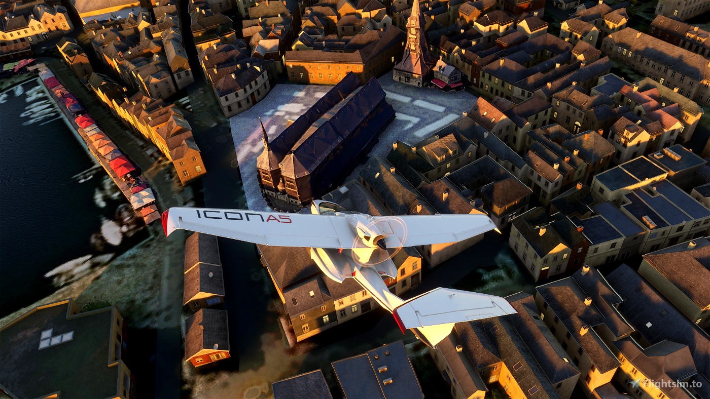
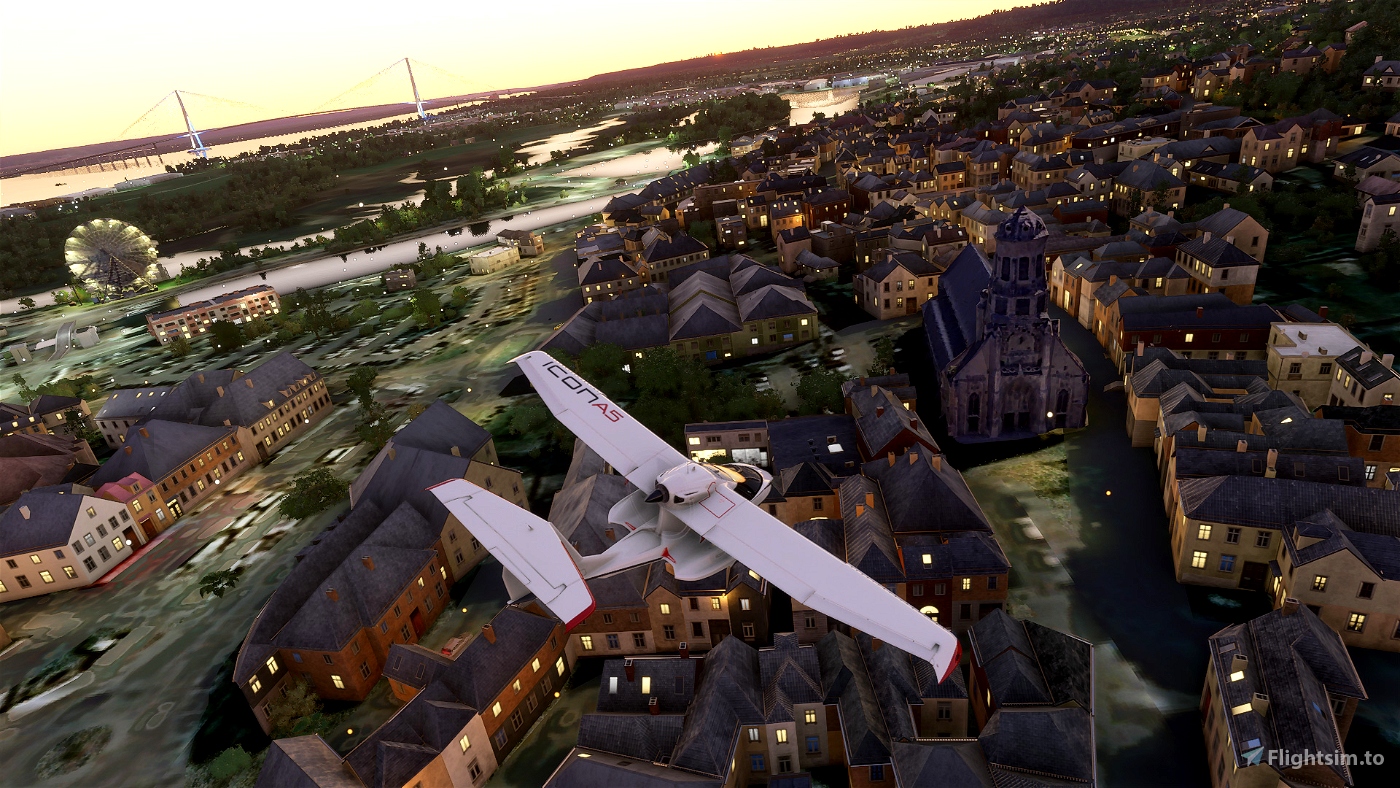
Location - Honfleur, France V2
GPS - 49.427120, 0.232056
Motivated by Cpt Ivanov's nice work on the Tancarville bridge and the Normandy bridge.
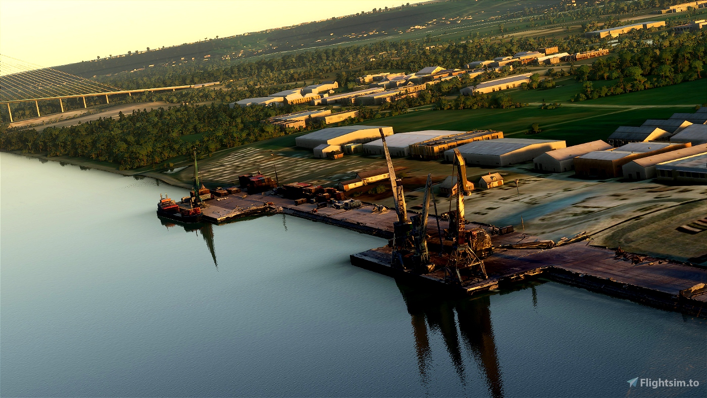
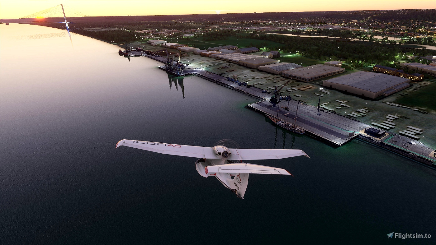
Honfleur is located in the Rouen creek in France.
Buildings (additions in red)
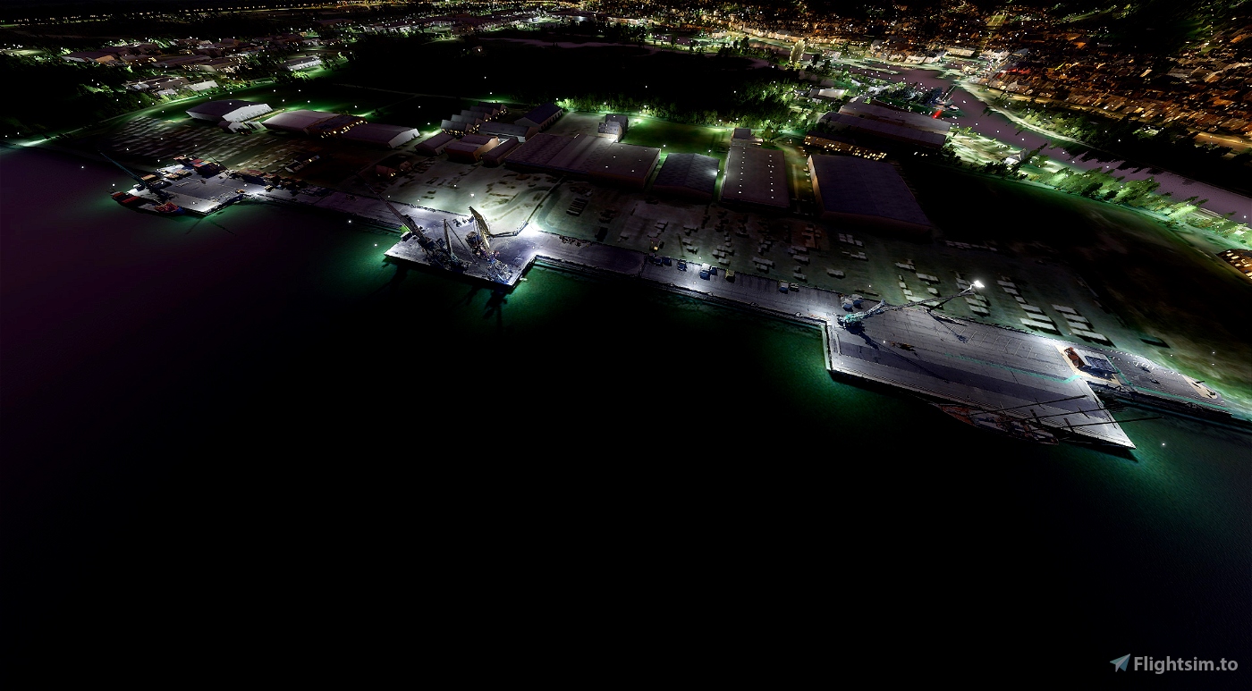
- Seaport
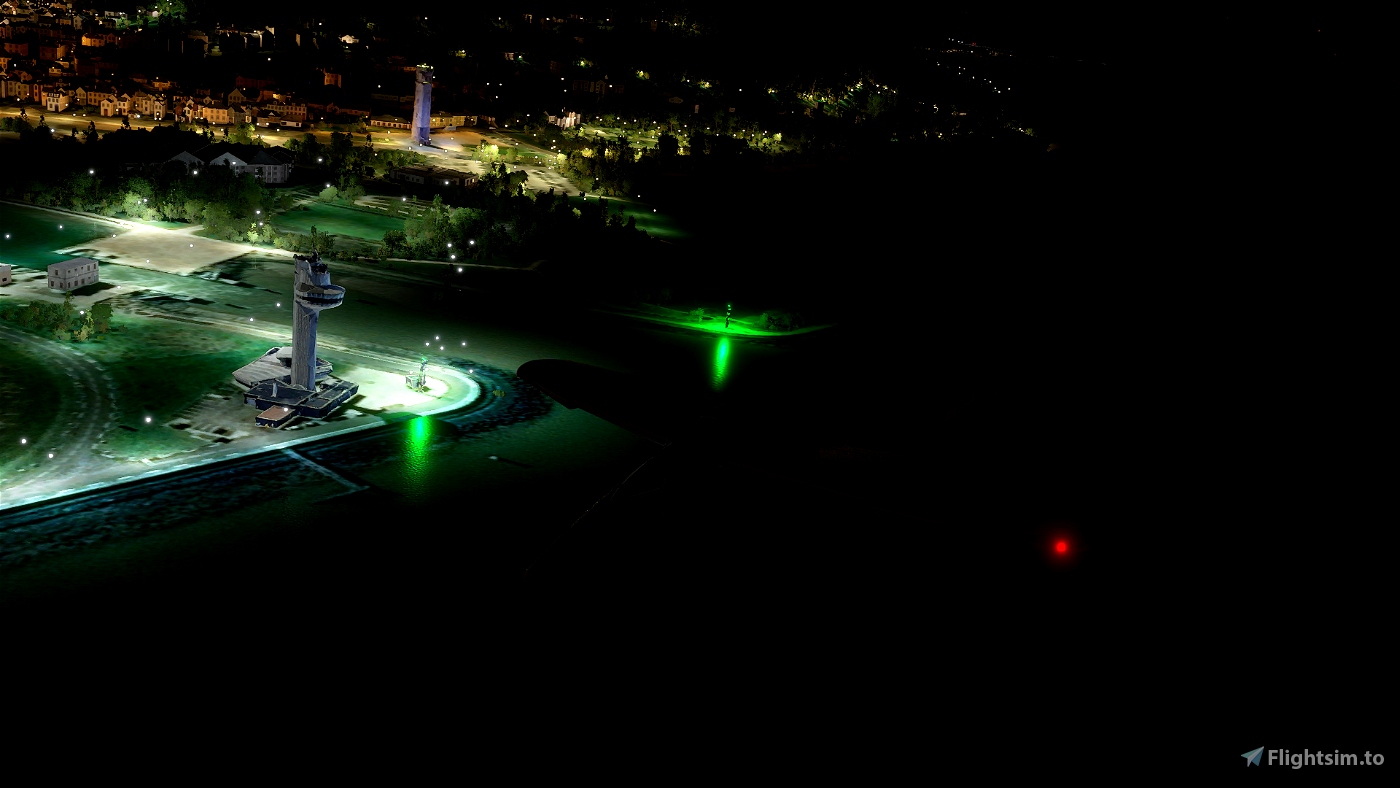
- East Pier Lighthouse (red light) + a few houses
- Honfleur's tower
- East and west dike lighthouse (green light)
- Sainte-Catehrine church + bell tower (largest church in France built in wood with a separate bell tower)
- Saint-Léonard church
- Market (0.1)
- Ferris wheel (0.1)
- Albert Sorel place
- Employment center
- Lighthouse "La falaise des fonds"
- Mediatheque
- Town hall
- Restaurant "La table des impressionnistes"
- Restaurant "La Lieutenance" (historical monument)
- Fish shop "L'Hyppocampe"
- Naturospace (plant & flower store)
- 14 houses & small buildings
+ more than 1000 parked cars
+ some trees removed
If you want me to add another building in this area, tell me.
Jgodagno
Motivé par le joli travail de Cpt Ivanov sur les ponts de Tancarville et Normandie.
Honfleur se trouve dans la crique de Rouen en France.
Bâtiments (ajouts en rouge)
- Port maritime
- Phare de la jetée Est (lumière rouge) + quelques maisons
- Phares entrée est & ouest (lumière verte)
- Tour de Honfleur
- Eglise Sainte-Catherine + clocher Sainte-Catherine (plus grande église de France construite en bois avec un clocher séparé)
- Eglise Saint-Léonard
- Marché (0.1)
- Grande roue (0.1)
- Place Albert Sorel
- Pôle emploi
- Phare de la falaise des fonds
- Mediathèque
- Mairie
- Restaurant "La table des impressionnistes"
- Restaurant "La Lieutenance" (monument historique)
- Poissonnerie "L'Hyppocampe"
- Naturospace
- 14 maisons & petit bâtiments
+ plus de 1000 voitures garées
+ suppression de quelques arbres
Si vous voulez que j'ajoute un autre bâtiment dans cette zone, dites moi.
Jgodagno
Installation - Copy the folders from the downloaded zip files into your community package folder.
File credits
This free creation contains content from Google Maps or Google Earth. In accordance with Google Terms of Services and especially point 2.2 of Google Maps/Google Earth Additional Terms of Service, this creation is based on « fair use » or « fair dealing » of the data provided by google throught its services. No commercial use or any gain is or will ever be made by the author of this creation, who doesn’t own anything regarding google assets but a simple user Licence. According to the following document https://www.google.com/intl/en-GB/permissions/geoguidelines/, the author is freely sharing a creative application of Google Maps or Google Earth. The author will not recieve any form of retribution for sharing his work, even general donations from users of file hosting web services under the form of « rewards » or « tips ». If this content would be found somewhere where it is provided in exchange of money or any kind of retribution, I wouldn’t be with the consent of the author who will stick to strict free content creation diffusion.
Part of this content including 3d data and textures is copyrighted by
Imagery ©2020 Google, Imagery ©2020 CNES/ Airbus, Maxar Technologies,
USDA Farm Service Agency, Map data ©2020 Google.


The content is amazing. Usually I download, try and delete. There no. In conjunction with the Normandy Bridge right next to it it's firmly anchored in my hard drive. Perfectly integrated into the surrounding landscape with magnificent details when you fly over very closely ... only compliments. Thank you so much. Frédéric
fr: Le contenu est prodigieux. D'habitude je télécharge j'essaye et j'efface. Là non. En conjonction avec le pont de Normandie tout à côté c'est solidement ancrée dans mon disque dur. Parfaitement intégré au paysage environnant avec des détails magnifiques lorsqu'on survole de très près… que des compliments. Merci beaucoup. Frédéric
4 years ago
zefredo
Omaha cemetery, Longues sur Mer and Pointe du Hoc deserve their makeover. I would like to know how to do it.
Congratulations to all in any case it's wonderful.
Fr : Magnifique tout cela. Par contre depuis que j'ai eu le malheur de toucher au fichier community je n'ai plus de batiment en 3D mis a part les lieux téléchargés. Maintenant c'est réinstallation sur réinstallation...
Le cimetière d'Omaha, Longues sur Mer et la Pointe du Hoc méritent leur relooking. J'aimerai savoir le faire.
Félicitations à tous en tout cas c'est magifique.
4 years ago
chocobn83
Thanks for your great job! Normandy is progressing quickly 😊
4 years ago
Ivanov
Indeed, Ivanov has already started a very good job on Le Havre center and the two bridges of Normandy and Tancarville.
All my congratulations on your additions!
I would like to get started to do the photogrammetry of Le Havre as well as LFOH, it is not an easy task according to the tutorials that I have seen.
We could perhaps join on a possible project, who knows?
Looking forward to reading you.
Good continuation !
En français:
Merci beaucoup !
En effet Ivanov a déjà commencé un très bon travail sur Le Havre centre et les deux ponts de Normandie et Tancarville.
Toutes mes félicitations pour tes ajouts !
J'aimerais m'y mettre pour faire la photogrammétrie du Havre ainsi que LFOH, ce n'est pas une tache facile d'après les tutos que j'ai vu.
On pourrait peut-être se joindre sur un éventuel projet, qui sait?
Au plaisir de te lire.
Bonne continuation !
4 years ago
Snaky